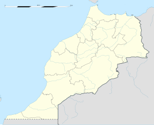
Ahfir
Appearance
Ahfir | |
|---|---|
Town | |
| Coordinates: 34°57′05″N 2°06′09″W / 34.95139°N 2.10250°W | |
| Country | |
| Region | Oriental |
| Province | Berkane |
| Area | |
| • Land | < See table @ Template:Infobox Settlement for details on automatic unit conversion--> km2 (Formatting error: invalid input when rounding sq mi) |
| Population (2004) | |
| • Total | 19,482 |
| Time zone | UTC+0 (WET) |
| • Summer (DST) | UTC+1 (WEST) |
Ahfir (Berber: Aḥfir, ⴰⵃⴼⵉⵔ; Arabic: احفير) is a town in Berkane Province, Oriental, Morocco, adjacent the border with Algeria. According to the 2004 census it has a population of 19,482.[1]
References
- ^ "World Gazetteer". Archived from the original on 2011-06-04. Retrieved 2010-02-04.


