Kitoy Goltsy
Appearance
| Kitoy Range | |
|---|---|
| Китойские гольцы | |
 | |
| Highest point | |
| Peak | Ospinsky Golets |
| Elevation | 3,215 m (10,548 ft) |
| Coordinates | 52°00′N 101°30′E / 52°N 101.5°E |
| Dimensions | |
| Length | 180 km (110 mi) |
| Geography | |
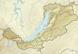
Location in Buryatia, Russia | |
| Location | Buryatia, Russia |
| Parent range | Eastern Sayan Mountains |
The Kitoy Range (Russian: Китойские гольцы) is a mountain range in Siberia, Russia, part of the Eastern Sayan Mountains.
Length: 180 km
Highest summit: 3215 m
Rivers: Kitoy River and other tributaries of the Angara River.
References
- "Abstract from BSE". Retrieved 2006-12-26. [dead link]

