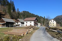
Podklanec, Žiri
Appearance
Podklanec | |
|---|---|
 | |
| Coordinates: 46°0′33.55″N 14°7′42.18″E / 46.0093194°N 14.1283833°E | |
| Country | |
| Traditional region | Upper Carniola |
| Statistical region | Upper Carniola |
| Municipality | Žiri |
| Area | |
| • Total | 0.68 km2 (0.26 sq mi) |
| Elevation | 498.2 m (1,634.5 ft) |
| Population (2002) | |
| • Total | 14 |
| [1] | |
Podklanec (pronounced [pɔtˈklaːnəts]; German: Podklanz[2]) is a small settlement south of Žiri in the Upper Carniola region of Slovenia. It lies at the end of a valley where Black Creek (Slovene: Črna) and Sovra Creek meet to become the Poljane Sora River (Slovene: Poljanska Sora).[3]
References
- ^ Statistical Office of the Republic of Slovenia
- ^ Leksikon občin kraljestev in dežel zastopanih v državnem zboru, vol. 6: Kranjsko. 1906. Vienna: C. Kr. Dvorna in Državna Tiskarna, pp. 124, 126.
- ^ Žiri municipal site
External links
 Media related to Podklanec at Wikimedia Commons
- Podklanec on Geopedia


