
Cracker Lake
| Cracker Lake | |
|---|---|
 A tent at Cracker Lake campground | |
| Location | Glacier National Park, Glacier County, Montana, United States |
| Coordinates | 48°44′40″N 113°38′35″W / 48.74444°N 113.64306°W[1] |
| Lake type | Natural |
| Primary inflows | Canyon Creek |
| Primary outflows | Canyon Creek |
| Basin countries | United States |
| Max. length | .60 miles (0.97 km) |
| Max. width | .15 miles (0.24 km) |
| Surface elevation | 5,910 ft (1,800 m) |
Cracker Lake is located in Glacier National Park, in the U. S. state of Montana. Located at the head of a canyon, the waters of Cracker Lake are an opaque turquoise from rock flour (silt) originating from Siyeh Glacier. To the south of Cracker Lake lies Mount Siyeh which rises more than 4,000 feet (1,200 m) above the lake. Cracker Peak to the southeast and Allen Mountain to the north are other prominent peaks nearby.[2] Cracker Lake is a 6.1-mile (9.8 km) hike from the Many Glacier Hotel.[3]
Gallery
-
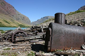 Mining equipment at the lake
 -
 Mining equipment at the lake


See also
List of lakes in Glacier County, Montana
References
- ^ "Cracker Lake". Geographic Names Information System. United States Geological Survey, United States Department of the Interior. Retrieved 2011-01-22.
- ^ "Logan Pass, MT" (Map (USGS Quad)). TopoQuest. Retrieved 2011-01-22.
- ^ "Day Hikes" (PDF). Plan Your Visit. National Park Service. Archived from the original (pdf) on 2014-08-01. Retrieved 2011-01-22.
This Montana state location article is a stub. You can help Wikipedia by expanding it. |