
New Era, Louisiana
New Era, Louisiana | |
|---|---|
 New Era, Louisiana  New Era, Louisiana | |
| Coordinates: 31°22′02″N 91°49′38″W / 31.36722°N 91.82722°W | |
| Country | United States |
| State | Louisiana |
| Parish | Concordia |
| Elevation | 52 ft (16 m) |
| Time zone | UTC-6 (Central (CST)) |
| • Summer (DST) | UTC-5 (CDT) |
| Area code | 318 |
| GNIS feature ID | 543517[1] |
New Era is an unincorporated community in Concordia Parish, Louisiana, United States. The community is located at the western edge of Concordia Parish on LA 129.
History
During the Antebellum period New Era was a small town on the Black River that served as a landing for steam boats. The steam boats would offload passengers and trade with nearby settlements. It was also the site of Pleasant Cottage plantation which was burned down during the Civil War.[2]
References
- ^ U.S. Geological Survey Geographic Names Information System: New Era, Louisiana
- ^ Walker, Bryant. "Concordia Parish Genealogy". theusgenweb.org. Retrieved 2019-08-19.
Municipalities and communities of Concordia Parish, Louisiana, United States | ||
|---|---|---|
| Cities | 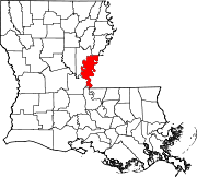 | |
| Towns | ||
| CDPs | ||
| Other communities |
| |
This Louisiana state location article is a stub. You can help Wikipedia by expanding it. |