
Norene, Tennessee
Norene, Tennessee | |
|---|---|
 Norene as seen from State Route 266 | |
| Coordinates: 36°03′24″N 86°14′33″W / 36.05667°N 86.24250°W | |
| Country | United States |
| State | Tennessee |
| County | Wilson |
| Elevation | 741 ft (226 m) |
| Time zone | UTC-6 (Central (CST)) |
| • Summer (DST) | UTC-5 (CDT) |
| ZIP code | 37136 |
| Area code | 615 |
| GNIS feature ID | 1304185[1] |
Norene is an unincorporated community in Wilson County, in the U.S. state of Tennessee. It is located along Tennessee State Route 266. The community has a general store, post office and churches.
History
The community was once called "Henderson's Cross Roads" by the local post office upon establishment in 1878. The community's name was officially changed to Norene on February 17, 1915.[2] By 1916 it was one of the eight largest villages in Wilson County with residents numbering 100. By 1930 the population had increased to 120.[3]
Photo gallery
-
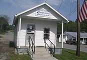 Norene Post Office
 -
 Norene General Store


Notes
- ^ "US Board on Geographic Names". United States Geological Survey. 2007-10-25. Retrieved 2008-01-31.
- ^ "History of Wilson County, Tennessee - Its Land and Its Life", G. Frank Burns, Editor, pg. 249.
- ^ "History of Wilson County, Tennessee - Its Land and Its Life", G. Frank Burns, Editor, pg. 250.
Municipalities and communities of Wilson County, Tennessee, United States | ||
|---|---|---|
| Cities |  | |
| Town | ||
| CDPs | ||
| Other communities | ||
| Ghost towns | ||
This Wilson County, Tennessee geography–related article is a stub. You can help Wikipedia by expanding it. |