
Tyro, Virginia
.jpg)

Tyro is an unincorporated community in Nelson County, Virginia, United States. It was among the communities severely affected by flash flooding from Hurricane Camille in 1969.[1]
It was named from the English word tyro, which also means "beginner" or "novice".[2][3]
Pharsalia and the Tyro Mill are listed on the National Register of Historic Places.[4]
References
- ^ Garnett P. Williams and Harold P. Guy. Erosional and Depositional Aspects of Hurricane Camille in Virginia, 1969. United States Government Printing Office, 1973, pp. 1.
- ^ "tyro". Merriam-Webster. Retrieved 16 June 2014.
- ^ Upham, Warren (2001). Minnesota Place Names: A Geographical Encyclopedia. Minnesota Historical Society Press. p. 649.
- ^ "National Register Information System". National Register of Historic Places. National Park Service. July 9, 2010.
Municipalities and communities of Nelson County, Virginia, United States | ||
|---|---|---|
| CDPs | 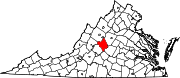 | |
| Other communities |
| |
| Footnotes | ‡This populated place also has portions in an adjacent county or counties | |
37°49′18″N 79°00′17″W / 37.82167°N 79.00472°W
This Nelson County, Virginia state location article is a stub. You can help Wikipedia by expanding it. |