
Garfield, Colorado

Garfield, elevation 9,541 feet (2,908 meters),[1] is a census-designated place (CDP) in Chaffee County, Colorado, United States. The population as of the 2010 Census was 15.[2]
Demographics
| Census | Pop. | Note | %± |
|---|---|---|---|
| 2010 | 15 | — | |
| U.S. Decennial Census[3] | |||
See also
References
- ^ "Garfield". Geographic Names Information System. United States Geological Survey, United States Department of the Interior.
- ^ Colorado Trend Report 2: State and Complete Places (Sub-state 2010 Census Data). Missouri Census Data Center. Accessed 2011-02-25.
- ^ "Census of Population and Housing". Census.gov. Retrieved June 4, 2016.
Municipalities and communities of Chaffee County, Colorado, United States | ||
|---|---|---|
| City | 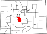 | |
| Towns | ||
| CDPs | ||
| Unincorporated communities | ||
38°33′06″N 106°17′32″W / 38.55167°N 106.29222°W
This Colorado-related article is a stub. You can help Wikipedia by expanding it. |