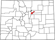
Sunnyside, Denver

Coordinates: 39°46′36″N 105°00′57″W / 39.77655°N 105.01586°W / 39.77655; -105.01586
From Wikipedia, the free encyclopedia

This is an old revision of this page, as edited by Smerph5 (talk | contribs) at 17:56, 7 March 2020 (Typo). The present address (URL) is a permanent link to this revision, which may differ significantly from the current revision.

Sunnyside on this map of Denver's neighborhoods

Sunnyside is a city-center neighborhood in Denver, Colorado, located in the Northside of Denver, west of Interstate 25.

The neighborhood is bounded by Union Pacific Railroad lines on the east, Interstate 70 on the north, Federal Boulevard on the West and 38th Avenue on the south.[1] It is bordered by the Highland neighborhood on the south and the Chaffee Park neighborhood on the north.

The neighborhood has a community group named Sunnyside United Neighbors, Inc (SUNI).

References

External links

39°46′36″N 105°00′57″W / 39.77655°N 105.01586°W / 39.77655; -105.01586