Rangiroa Airport
Appearance
Rangiroa Airport Aéroport de Rangiroa | |||||||||||
|---|---|---|---|---|---|---|---|---|---|---|---|
| Summary | |||||||||||
| Airport type | Public | ||||||||||
| Operator | S.E.T.I.L. Aéroports | ||||||||||
| Location | Rangiroa | ||||||||||
| Elevation AMSL | 3.66 m / 12 ft | ||||||||||
| Coordinates | 14°57′23.04″S 147°39′32.76″W / 14.9564000°S 147.6591000°W | ||||||||||
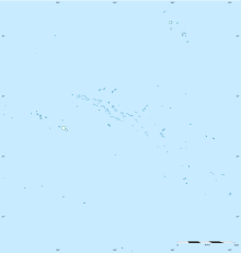
| Map | |||||||||||
 | |||||||||||
| Runways | |||||||||||
| |||||||||||
Rangiroa Airport is an airport on the island of Rangiroa, French Polynesia (IATA: RGI, ICAO: NTTG). The airport is located on the northwestern edge of the atoll, 5.5 km southeast of Avatoru. The airport was built in 1965.[1] Air Tahiti has regular daily flights connecting Rangiroa to other islands of French Polynesia.[2] In 2018, 89,122 passengers utilized the airport.[3]
Airlines and destinations
Passenger
| Airlines | Destinations |
|---|---|
| Air Tahiti | Bora Bora, Fakarava, Manihi, Mataiva, Papeete, Tikehau[4] |
Accidents and incidents
On February 19, 1985, a UTA DC-10 operating from Los Angeles to Auckland via Tahiti made an emergency landing at Rangiroa following a telephoned bomb threat. Passengers and luggage were removed and flown to Tahiti onboard French military aircraft. The aircraft was searched and no bomb was found. The aircraft was flown empty to Tahiti a week later.[5]
References
- ^ La SETIL Aéroports Accessed 12 February 2010
- ^ (RGI) Rangiroa Airport Departures, Arrivals and Information Publisher : flightstats.com Accessed 12 February 2010
- ^ French) Archived 2006-11-24 at the Wayback Machine Accessed 12 February 2010
- ^ https://www.airtahiti.com/download-schedule
- ^ https://apnews.com/25c1d86be3b48b42248429fe77881d20
External links
- Rangiroa Airport
- NTTG – RANGIROA. AIP from French Service d'information aéronautique, effective 26 December 2024.
- Photograph of Rangiroa Airport terminal and control tower From Airliners.net. Retrieved 14 February 2010.

