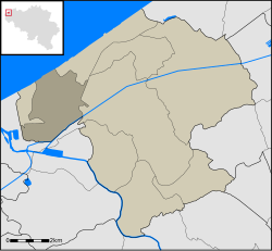
Westende
Appearance
Westende | |
|---|---|
 | |
| Coordinates: 51°09′34″N 2°46′06″E / 51.15944°N 2.76833°E | |
| Country | Belgium |
| Province | |
| Municipality | Middelkerke |
| Source: NIS | |
| Postal code | 8434 |
Westende is a town in Flanders, one of the three regions of Belgium, and in the Flemish province of West-Flanders. It lies on the Belgian coast, also called Flemish coast. It used to be the far west (West-ende: Dutch for west-end) of the island Testerep which lay along the Belgian coast.
51°10′N 2°46′E / 51.167°N 2.767°E
