Gongala
Appearance
| Gongala | |
|---|---|
 | |
| Highest point | |
| Elevation | 1,358 m (4,455 ft) |
| Coordinates | 6°23′9″N 80°39′14″E / 6.38583°N 80.65389°E |
| Geography | |
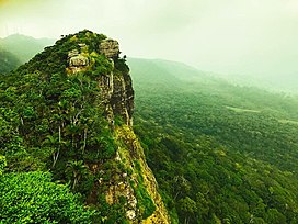
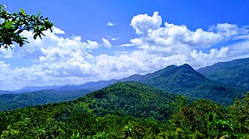
Gongala is a mountain in the Ratnapura District of Sri Lanka. At a summit elevation of 1,358 m (4,455 ft), it is the 15th tallest mountain in Sri Lanka.[1][2][3]

See also
References
- ^ Survey Department of Sri Lanka (2007). The National Atlas of Sri Lanka (Second Edition) (2nd ed.). p. 36. ISBN 955-9059-04-1. OL 23136585M. Wikidata Q87733463.
- ^ "Gongala, Sri Lanka". GeoNames. Retrieved 19 March 2020.
- ^ "Gongala, Province of Sabaragamuwa, Sri Lanka". Mindat.org. Retrieved 19 March 2020.

