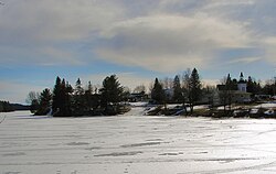
Dunchurch, Ontario
Appearance
Dunchurch | |
|---|---|
Town | |
 | |
| Coordinates: 45°39′N 79°51′W / 45.650°N 79.850°W | |
| Country | Canada |
| Province | Ontario |
| Census Division | Parry Sound District |
| Municipality | Whitestone |
| Time zone | UTC-5 (Eastern (EST)) |
| • Summer (DST) | UTC-4 (EDT) |
| Postal Code | P0A 1G0 |
| Area code | 705 |
| [1][2] | |
Dunchurch is a community in the Canadian province of Ontario, located in the municipality of Whitestone in Parry Sound District.
History
In 1873, the community was give the name Newcombe. To avoid confusion with similarly named places in the province, in 1877 postmaster George Kelcey renamed it after his birthplace in Warwickshire, England.[3]
External links
References
- ^ "Post Office Locator - Dunchurch, Ontario". Canada Post. Retrieved 2008-06-09.
- ^ "CO Code Status". Canadian Numbering Administrator. Archived from the original on 2008-06-11. Retrieved 2008-06-09.
- ^ Rayburn, Alan (1997). Place names of Ontario. Toronto: University of Toronto Press. p. 98. ISBN 0-8020-7207-0. Retrieved 16 October 2017.
45°39′N 79°51′W / 45.65°N 79.85°W
