Ausserberg railway station
Ausserberg | |||||
|---|---|---|---|---|---|
 The station building in 2018 | |||||
| General information | |||||
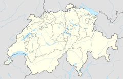
| Location | Bigstatt, Ausserberg, Canton of Valais, Switzerland | ||||
| Coordinates | 46°18′45″N 7°50′34″E / 46.312464°N 7.842822°E | ||||
| Elevation | 932 m (3,058 ft) | ||||
| Owned by | BLS AG | ||||
| Operated by | BLS AG | ||||
| Line(s) | Lötschberg line | ||||
| Connections | PostAuto bus service | ||||
| Services | |||||
|
Lua error in Module:Adjacent_stations at line 237: Unknown line "RegioExpress". | |||||
| |||||
Ausserberg is a railway station in the Swiss canton of Valais and municipality of Ausserberg. The station is located on the Lötschberg line of the BLS AG, and is some 900 metres (3,000 ft) from the centre of Trogdorf, the main village of Ausserberg.[1]
The station is served by the following passenger train:[2]
| Operator | Train Type | Route | Typical Frequency |
Notes |
|---|---|---|---|---|
| BLS | RegioExpress Lötschberger |
Bern - Münsingen - Thun - Spiez - Mülenen - Reichenbach im Kandertal - Frutigen - Kandersteg - Goppenstein - Hohtenn - Ausserberg - Eggerberg - Lalden - Brig | 1 per hour |
A connecting PostAuto bus service links the station with Trogdorf village, Baltschieder and Visp.[3]
Ausserberg station is an intermediate point of the Lötschberg South Ramp walking trail, which parallels the south ramp of the Lötschberg railway as it descends the northern flank of the Rhone valley into Brig. The walk covers the 23 kilometres (14 mi) from Hohtenn station to Brig, passing by the stations of Ausserberg, Eggerberg and Lalden on the way, and offering views south over the Rhone valley.[4][5]
Gallery
-
Looking east from the station
-
Looking west from the station
References
- ^ map.geo.admin.ch (Map). Swiss Confederation. Retrieved 2013-10-14.
- ^ "Spiez–Lötschberg–Brig" (PDF). Bundesamt für Verkehr. Retrieved 2013-10-14.
- ^ "Visp–Ausserberg" (PDF). Bundesamt für Verkehr. Retrieved 2013-10-17.
- ^ "Southern Lötschberg ramp - The classic hike". BLS AG. Retrieved 2013-10-16.
- ^ "Loetschberger-Suedrampe". BLS AG. Archived from the original on 2013-10-17. Retrieved 2013-10-16.
External links
 Media related to Ausserberg railway station at Wikimedia Commons
- Ausserberg railway station – SBB


