
Bolešiny
Bolešiny | |
|---|---|
Municipality | |
 | |
 Flag  Coat of arms | |
 Bolešiny | |
| Coordinates: 49°24′28″N 13°21′34″E / 49.40778°N 13.35944°E | |
| Country | |
| Region | Plzeň |
| District | Klatovy |
| Area | |
| • Total | 15.65 km2 (6.04 sq mi) |
| Elevation | 422 m (1,385 ft) |
| Population (1.1.2015) | |
| • Total | 767 |
| • Density | 49/km2 (130/sq mi) |
| Postal code | 339 01 |
| Website | http://www.bolesiny.cz |
Bolešiny is a village and municipality (obec) in Klatovy District in the Plzeň Region of the Czech Republic.
The municipality covers an area of 15.65 square kilometres (6.04 sq mi), and has a population of 677 (as at 28 August 2006).
Bolešiny lies approximately 6 kilometres (4 mi) east of Klatovy, 38 km (24 mi) south of Plzeň, and 108 km (67 mi) south-west of Prague.
References
Wikimedia Commons has media related to Bolešiny.
Gallery
-
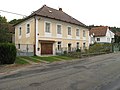 Houses
 -
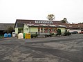 Shop
Shop -
 Village green
.jpg)
.jpg)
.jpg)
| Authority control databases: National |
|---|
This Plzeň Region location article is a stub. You can help Wikipedia by expanding it. |