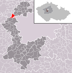
Dobrovíz
Appearance
Dobrovíz | |
|---|---|
Municipality and village | |
 | |
 | |
| Coordinates: 50°6′44″N 14°13′21″E / 50.11222°N 14.22250°E | |
| Country | |
| Region | Central Bohemian Region |
| District | Prague-West District |
| Area | |
| • Total | 5.97 km2 (2.31 sq mi) |
| Elevation | 344 m (1,129 ft) |
| Population (2010) | |
| • Total | 473 |
| • Density | 79/km2 (210/sq mi) |
| Time zone | UTC+1 (CET) |
| • Summer (DST) | UTC+2 (CEST) |
| Post code | 252 61 |
| Website | http://www.obec-dobroviz.eu |
Dobrovíz is located on the west side of Prague, close to Prague International Airport. 477 citizens.
Transport
- Bus line 319 from Prague International Airport
- Bus line A26 from Kladno
- Train from Praha Masarykovo nádraží to Slaný (goes weekends only)

Nowadays projects
- projekt Cargoport close to coming soon highway R6 Prague-Karlovy Vary
Wikimedia Commons has media related to Dobrovíz.
