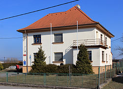
Heřmanova Huť
Appearance
Heřmanova Huť | |
|---|---|
Municipality | |
 Municipal office | |
| Coordinates: 49°42′43″N 13°05′15″E / 49.71194°N 13.08750°E | |
| Country | |
| Region | Plzeň |
| District | Plzeň North |
| Government | |
| • Mayor | Radek Lukáč |
| Area | |
| • Total | 9.87 km2 (3.81 sq mi) |
| Elevation | 380 m (1,250 ft) |
| Population (2019) | |
| • Total | 1,794[1] |
| • Density | 182/km2 (470/sq mi) |
| Postal code | 330 24 |
| Website | www.hermanovahut.cz |
Heřmanova Huť (German: Hermannshütte) is a village and municipality (obec) in Plzeň-North District in the Plzeň Region of the Czech Republic.
History
The village of Heřmanova Huť was founded in 1954 through the merger of three former villages: Vlkýš, Dolní Sekyřany and Horní Sekyřany.
Population history
| Year | 1961 | 1970 | 1980 | 1991 | 2001 | 2011 |
|---|---|---|---|---|---|---|
| Population | 1803 | 1810 | 1860 | 1745 | 1755 | 1762 |
Gallery
-
Train station
-
Revoluční street
-
Elementrary school
References
- ^ "Population of Municipalities as of 1 January 2019". Czech Statistical Office. Retrieved 21 December 2019.


