Láb
Láb | |
|---|---|
Municipality | |
 All Saints' Church | |
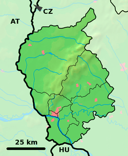
Location of Láb in the Bratislava Region | |
| Coordinates: 48°21′50″N 16°58′20″E / 48.36389°N 16.97222°E | |
| Country | Slovakia |
| Region | Bratislava |
| District | Malacky |
| First mentioned | 1206 |
| Elevation | 152 m (499 ft) |
| Postal code | 900 67 |
| Area code | 421-34 |
| Car plate | MA |
| Website | www.obeclab.sk |
Láb is a village and municipality in western Slovakia in Malacky District in the Bratislava region.
Etymology
The name derives from Loyp (Leopold). Terra Loyp (1206), silva Loyp (1271), Laab (1400).[1]
References
- ^ Varsik, Branislav (1984). Z osídlenia západného a stredného Slovenska v stredoveku (in Slovak). Bratislava: Veda, vydavateľstvo Slovenskej akadémie vied. p. 103.
External links
![]() Media related to Láb at Wikimedia Commons
Media related to Láb at Wikimedia Commons
- Official page
- https://web.archive.org/web/20070513023228/http://www.statistics.sk/mosmis/eng/run.html


