
Oborná
Oborná | |
|---|---|
Village | |
 Chapel | |
 Flag  Coat of arms | |
 Oborná Location in the Czech Republic | |
| Coordinates: 50°00′N 17°30′E / 50.000°N 17.500°E | |
| Country | |
| Region | Moravian-Silesian Region |
| District | Bruntál District |
| Time zone | UTC+1 (CET) |
| • Summer (DST) | UTC+2 (CEST) |
Oborná, until 1947 Špilendorf (German: Spillendorf), is a village in the Moravian-Silesian Region of the Czech Republic. It has around 320 inhabitants.
According to the Austrian census of 1910, the village had 511 inhabitants, 504 of whom had permanent residence there. The census asked people for their native language, and 504 (100%) were German-speaking. The most-populous religious group was Roman Catholics with 505 (98.8%).[1]
Galerie
-
 Playground
 -
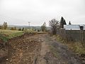 Reparation of the road
 -
 Bus
Bus


Wikimedia Commons has media related to Oborná.
References
- ^ Ludwig Patryn (ed): Die Ergebnisse der Volkszählung vom 31. Dezember 1910 in Schlesien, Troppau 1912.
External links
- "Obec Oborná - Úřady podle regionů - Portál veřejné správy České republiky" (in Czech). Short official information about the village
This Moravian-Silesian Region location article is a stub. You can help Wikipedia by expanding it. |