
Černíkov
Černíkov | |
|---|---|
Municipality | |
 | |
 Flag  Coat of arms | |
 Černíkov | |
| Coordinates: 49°25′33″N 13°7′15″E / 49.42583°N 13.12083°E | |
| Country | |
| Region | Plzeň |
| District | Klatovy |
| Area | |
| • Total | 16.71 km2 (6.45 sq mi) |
| Elevation | 498 m (1,634 ft) |
| Population (2010) | |
| • Total | 331 |
| • Density | 20/km2 (51/sq mi) |
| Postal code | 345 06 to 345 11 |
| Website | http://www.cernikov.cz |
Černíkov is a village and municipality (obec) in Klatovy District in the Plzeň Region of the Czech Republic.
The municipality covers an area of 16.71 square kilometres (6.45 sq mi), and has a population of 323 (as at 28 August 2006).
Černíkov lies approximately 13 kilometres (8 mi) west of Klatovy, 41 km (25 mi) south-west of Plzeň, and 119 km (74 mi) south-west of Prague.
Gallery
-
 The pub
 -
 Municipal office
 -
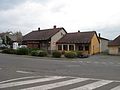
 Town road


References
Wikimedia Commons has media related to Černíkov.
| Authority control databases: National |
|---|
This Plzeň Region location article is a stub. You can help Wikipedia by expanding it. |