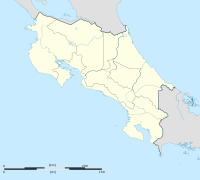
Monte Romo
Appearance
Monte Romo | |
|---|---|
District and village | |
| Coordinates: 09°59′58″N 85°22′57″W / 9.99944°N 85.38250°W | |
| Country | Costa Rica |
| Province | Guanacaste |
| Canton | Hojancha |
| Area | |
| • Total | 74.85 km2 (28.90 sq mi) |
| Elevation | 685 m (2,247 ft) |
| Population (June 2013) | |
| • Total | 718 |
| • Density | 9.6/km2 (25/sq mi) |
| Postal code | 51102 |
Monte Romo District is a district and village in the canton of Hojancha, Guanacaste Province in Costa Rica.[1]
The district has a population of around 700 people.[2]
Villages
Administrative center of the district is the village of Monte Romo.
Other villages in the district are Altos del Socorro, Bajo Saltos, Cabrera, Cuesta Roja, Delicias, Guapinol, Loros, Mercedes, Palmares, Río Zapotal, San Isidro and Trinidad.[1]
References
- ^ a b "Monte Romo". Archived from the original on 2015-04-02. Retrieved 2015-03-24.
- ^ Estadísticas Vitales 2013 Archived 2015-04-02 at the Wayback Machine - INEC

