
Bogue Chitto, Lincoln County, Mississippi
Bogue Chitto, Lincoln County, Mississippi | |
|---|---|
 Bogue Chitto Location in Mississippi  Bogue Chitto Location in the United States | |
| Coordinates: 31°26′20″N 90°27′08″W / 31.43889°N 90.45222°W | |
| Country | United States |
| State | Mississippi |
| County | Lincoln |
| Area | |
| • Total | 2.26 sq mi (5.85 km2) |
| • Land | 2.26 sq mi (5.85 km2) |
| • Water | 0.0 sq mi (0.0 km2) |
| Elevation | 404 ft (123 m) |
| Population (2010) | |
| • Total | 522 |
| • Density | 231/sq mi (89.2/km2) |
| Time zone | UTC-6 (Central (CST)) |
| • Summer (DST) | UTC-5 (CDT) |
| ZIP code | 39629 |
| GNIS feature ID | 667378[1] |
| FIPS code | 28-07340 |
Bogue Chitto is an unincorporated community and census-designated place (CDP) in Lincoln County, Mississippi, United States. As of the 2010 census, it had a population of 522.[2] Bogue Chitto is the only municipal hamlet in the state of Mississippi.[3]
History
Bogue Chitto takes its name from the nearby Bogue Chitto River, the name of which is a Native American word meaning "big creek".[4]
The population in 1900 was 582. At that time, the settlement had telephone and telegraph services, a school, and several churches. The local economy involved the lumber industry, and a lumber mill and cotton gin were located there.[4]
The settlement is located on a branch of the Illinois Central Railroad.[4]
Geography
Bogue Chitto is in southern Lincoln County, west of the Bogue Chitto River and east of Interstate 55, which provides access to the town at Exit 30 (Bogue Chitto Road). I-55 leads north 65 miles (105 km) to Jackson, the state capital, and south the same distance to Hammond, Louisiana. U.S. Route 51 runs through the community, just west of the center of town and parallel to I-55. US 51 leads north 10 miles (16 km) to Brookhaven, the Lincoln county seat, and south 14 miles (23 km) to McComb.
According to the U.S. Census Bureau, the Bogue Chitto CDP has an area of 2.2 square miles (5.8 km2), all of it recorded as land. The Bogue Chitto River flows south past the community, then southeast into Louisiana, where it joins the Pearl River.
Education
Bogue Chitto is part of the Lincoln County School District. The Bogue Chitto Attendance Center serves area students in grades K-12. The community's first school was built in 1924. The original Art Deco-style building was demolished in 2003 by Jackson Salvage Company.
References
- ^ U.S. Geological Survey Geographic Names Information System: Bogue Chitto
- ^ "Total Population: 2010 Census DEC Summary File 1 (P1), Bogue Chitto CDP (Lincoln County), Mississippi". data.census.gov. U.S. Census Bureau. Retrieved April 8, 2020.
- ^ "Bogue Chitto Gets Grant for Street Work". The Daily Leader. 21 February 2012.
- ^ a b c Rowland, Dunbar (1907). Mississippi: Comprising Sketches of Counties, Towns, Events, Institutions, and Persons, Arranged in Cyclopedic Form. Vol. 1. Southern Historical Publishing Association. p. 259.
Municipalities and communities of Lincoln County, Mississippi, United States | ||
|---|---|---|
| Cities | 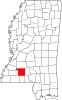 | |
| Town | ||
| CDPs | ||
| Other unincorporated communities | ||
| Ghost town | ||
| Footnotes | ‡This populated place also has portions in an adjacent county or counties | |
| International | |
|---|---|
| National | |