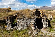
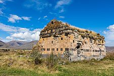
Lori Berd
Appearance
Lori Berd Լոռի բերդ | |
|---|---|
 | |
| Coordinates: 41°0′45.50″N 44°24′45.39″E / 41.0126389°N 44.4126083°E | |
| Country | Armenia |
| Marz (Province) | Lori Province |
| Elevation | 1,379 m (4,524 ft) |
| Population (2001) | |
| • Total | 450 |
| Time zone | UTC+4 ( ) |
Lori Berd (Template:Lang-hy) is a village in the Lori Province of Armenia, just east of Stepanavan. It is the site of the medieval fortress "Lori Berd" located on a peninsula along the deep gorge cut by the Dzoraget and Tashir rivers. Lori Berd is situated at an altitude of 1379 m.[1]
History
This section is empty. You can help by adding to it. (February 2013) |
Gallery
See also
Nearby towns
Nearby villages
References
- Lori Berd at GEOnet Names Server
- Report of the results of the 2001 Armenian Census, Statistical Committee of Armenia


