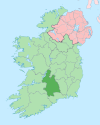
Ballina, County Tipperary
Ballina
Béal an Átha | |
|---|---|
Town | |
 Killaloe Bridge, joining Ballina and Killaloe | |
| Coordinates: 52°48′24″N 8°26′06″W / 52.8067°N 8.435°W | |
| Country | Ireland |
| Province | Munster |
| County | County Tipperary |
| Elevation | 20 m (70 ft) |
| Population (2016)[1] | |
| • Total | 2,632 |
| Irish Grid Reference | R704736 |
Ballina (historically Bellanaha, from Irish: Béal an Átha),[2] meaning "Mouth of the Ford", is a village that lies on the River Shannon in County Tipperary, Ireland. It is situated on the eastern shore of Lough Derg across from its 'twin-town' of Killaloe on the west bank of the lake. The towns are joined by Killaloe Bridge.
The annual Brian Boru Festival takes place in early July each year. A joint celebration between the two towns of the ancient High King of Ireland, Brian Boru, it involves many community-based activities including a hurling match between the teams from both towns.
Ballina has a primary school, Ballina National School, with the nearest secondary school, St. Anne's Community College, present in Killaloe.
History
Ballina was an important stopping point for barges traveling up the Shannon along with Killaloe. Back in the 19th and early 20th century dockers and bargemen would pass through Ballina to go to Dublin to deliver their goods. However this began to decline when train lines were set up to link it to other major lines, making the transport of goods cheaper. As a result the barges eventually disappeared in the 1920s and 1930s. They came back for a brief period during the Emergency but vanished some time after that. The railway tracks were removed in the 1950s, having fallen into disrepair. New lines which linked Limerick directly to Dublin meant there was no need for them, and they were taken up.
During the War of Independence (1919–1921), three young men were shot on the bridge as suspected IRA men by the Black and Tans and auxiliaries. There is now a headstone where the men were shot in honour of their memory.
Transport
For a long period,[vague] there was no traffic control system present on the bridge. While it was possible for cars to pass each other, it was difficult for HGVs and cars, and impossible for two HGVs, to pass. This led to the introduction of a traffic light system which, while leading to delays at peak times, has improved safety and traffic flow on the bridge. There are plans[citation needed] to build a new bridge downstream, as the existing bridge is preserved and cannot be widened.
In December 2006 North Tipperary County Council sought tenders for a 'design and build' contract for the new Shannon crossing.[3][needs update]
Sport
Ballina has a G.A.A. club which is made up of Ballina and Boher. In 1885 Ballina GAA club was formally established. At a convention in Nenagh on Sunday 20 November 1887, 35 affiliated clubs were represented by their respective delegates. This list of 35 included two from the parish, namely Ballina and Boher. In 1902 Michael Minihan of Boher became North Tipperary Chairman. In 1883 a Ballina / Boher combination under the name of Kincora, beat Killaloe. Which is one of the first inter-county games on record, with Kincora recording a victory of 2-1 to 0-1.[1]
See also
References
- ^ "Census 2016 Sapmap Area: Settlements Ballina". Central Statistics Office (Ireland). Retrieved 22 April 2019.
- ^ Placenames Database of Ireland (see archival records)
- ^ "Shannon Bridge". North Tipperary County Council. Retrieved 26 January 2020.


