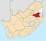
Dundonald, Mpumalanga
Appearance
Dundonald
Dondoni | |
|---|---|
| Coordinates: 26°14′17″S 30°49′55″E / 26.238°S 30.832°E | |
| Country | South Africa |
| Province | Mpumalanga |
| District | Gert Sibande |
| Municipality | Albert Luthuli |
| Area | |
| • Total | 5.51 km2 (2.13 sq mi) |
| Population (2011)[1] | |
| • Total | 4,764 |
| • Density | 860/km2 (2,200/sq mi) |
| Racial makeup (2011) | |
| • Black African | 99.3% |
| • Coloured | 0.1% |
| • Indian/Asian | 0.3% |
| • White | 0.2% |
| • Other | 0.1% |
| First languages (2011) | |
| • Zulu | 57.5% |
| • Swazi | 38.9% |
| • Other | 3.6% |
| Time zone | UTC+2 (SAST) |
| Postal code (street) | 2335 |
| PO box | 2336 |
| Area code | 017 |
Dundonald is a village in Gert Sibande District Municipality in the Mpumalanga province of South Africa. It was formerly part of the KaNgwane homeland.[2]
References
- ^ a b c d "Main Place Dundonald". Census 2011.
- ^ "My Hometown: Dundonald, Mpumalanga". eNCA. Retrieved 17 July 2016.


