
Essen (Oldenburg)
Essen | |
|---|---|
_COA.svg) Coat of arms | |
Location of Essen within Cloppenburg district 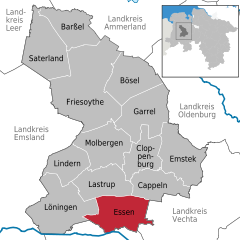 | |
 Essen  Essen | |
| Coordinates: 52°43′16″N 7°56′26″E / 52.72111°N 7.94056°E | |
| Country | Germany |
| State | Lower Saxony |
| District | Cloppenburg |
| Subdivisions | 14 Ortsteile |
| Government | |
| • Mayor | Heiner Kreßmann |
| Area | |
| • Total | 97.97 km2 (37.83 sq mi) |
| Elevation | 26.10 m (85.63 ft) |
| Population (2022-12-31)[1] | |
| • Total | 9,101 |
| • Density | 93/km2 (240/sq mi) |
| Time zone | UTC+01:00 (CET) |
| • Summer (DST) | UTC+02:00 (CEST) |
| Postal codes | 49632 |
| Dialling codes | 0 54 34 |
| Vehicle registration | CLP |
| Website | essen-oldb.de |
Essen is a municipality in the district of Cloppenburg, in Lower Saxony, Germany. It is on the river Hase, about 5 km north of Quakenbrück and 15 km southwest of Cloppenburg.
Essen consists of the following parts: Addrup, Ahausen, Barlage, Bartmannsholte, Beverdiek, Bevern, Bokel, Brokstreek, Calhorn, Darrel, Essen-Ort, Felde, Gut Lage, Herbergen, Hülsenmoor, Nordholte, Osteressen, Sandloh and Uptloh.
Wikimedia Commons has media related to Essen (Oldenburg).
Towns and municipalities in Cloppenburg (district) | ||
|---|---|---|
 | ||
References
| International | |
|---|---|
| National | |
| Geographic | |
This Cloppenburg district location article is a stub. You can help Wikipedia by expanding it. |