Di Lido Island
Appearance
Di Lido Island | |
|---|---|
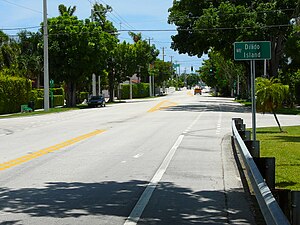
 Eastward on the Venetian Causeway at Di Lido Island | |
| Country | United States |
| State | Florida |
| County | Miami-Dade County |
| City | Miami Beach |
| Government | |
| • Miami Beach Mayor | Dan Gelber |
| • Miami-Dade County Commissioner | Audrey Edmonson |
| • House of Representatives | Cynthia A. Stafford (D) |
| • State Senate | Gwen Margolis (D) |
| • U.S. House | Ileana Ros-Lehtinen (R) |
| Elevation | 3 ft (0.9 m) |
| Population (2010) | |
| • Total | 230 |
| Time zone | UTC-05 (EST) |
| ZIP Code | 33139 |
| Area code(s) | 305, 786 |
Di Lido Island is a neighborhood in the city of Miami Beach on a man-made island in Biscayne Bay, Florida, United States. It is the third island from the east of the Venetian Islands, a chain of artificial islands in Biscayne Bay in the cities of Miami and Miami Beach.[1] It is between San Marino Island and Rivo Alto Island. It is home to residential neighborhoods and a portion of the Venetian Causeway. The unfinished artificial island Isola di Lolando from the Florida land boom of the 1920s is located near the north tip of Di Lido Island.
Notable residents
- Arne Quinze
- Barbara Becker
- Paulina Rubio
- Susana Gimenez
References
25°47′27″N 80°09′32″W / 25.790869°N 80.15898°W

