
Kendall, Kansas
Kendall, Kansas | |
|---|---|
 | |
 Kendall  Kendall | |
| Coordinates: 37°56′5″N 101°32′46″W / 37.93472°N 101.54611°W | |
| Country | United States |
| State | Kansas |
| County | Hamilton |
| Elevation | 3,140 ft (960 m) |
| Time zone | UTC-7 (Mountain (MST)) |
| • Summer (DST) | UTC-6 (MDT) |
| ZIP code | 67857 |
| Area code | 620 |
| FIPS code | 20-36400 |
| GNIS ID | 471586 [1] |
Kendall is an unincorporated community in Hamilton County, Kansas, United States. Kendall is located near U.S. Route 50 and U.S. Route 400 12 miles (19 km) southeast of Syracuse. Kendall has a post office with ZIP code 67857.[2]
History
The frontiersman Charles "Buffalo" Jones, who in 1879 had co-founded Garden City, left from Kendall in 1886 on a hunt to try to capture remaining buffalo to prevent their looming extinction.[3]
Education
Kendall is a part of USD 494 Syracuse.[4]
Kendall schools were closed through school unification. The Kendall High School mascot was Kendall Bobcats.[5]
See also
References
- ^ "US Board on Geographic Names". United States Geological Survey. 2007-10-25. Retrieved 2008-01-31.
- ^ ZIP Code Lookup
- ^ "Buffalo Jones". h-net.msu.edu. Archived from the original on March 6, 2012. Retrieved September 4, 2010.
- ^ "USD 494 Syracuse". USD 494. Retrieved 6 January 2017.
- ^ "Kendall Downs Russell Springs", Garden City Telegram, 6 January 1966, p.5.
Further reading
External links
Municipalities and communities of Hamilton County, Kansas, United States | ||
|---|---|---|
| Cities | 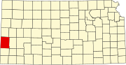 | |
| Unincorporated communities | ||
| Townships | ||
This article about a location in Hamilton County, Kansas is a stub. You can help Wikipedia by expanding it. |