Yarck, Victoria
Appearance
| Yarck Victoria | |
|---|---|
 General store | |
| Coordinates | 37°05′23″S 145°36′40″E / 37.08972°S 145.61111°E |
| Population | 168 (2016 census)[1] |
| Postcode(s) | 3719 |
| Location | |
| LGA(s) | Shire of Murrindindi |
| State electorate(s) | Eildon |
| Federal division(s) | Indi |
Wikimedia Commons has media related to Yarck, Victoria.
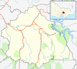
Yarck is a town in the upper Goulburn Valley region of Victoria, Australia. The town is in the Shire of Murrindindi and on the Maroondah Highway, 166 kilometres (103 mi) north east of the state capital, Melbourne. At the 2016 census, Yarck and the surrounding area had a population of 168.[1]
Yarck Post Office opened around February 1877.[2] The railway arrived in 1890 and the station was closed in 1978.
Facilities in town include a general store, hotel/pub, 2 cafes, book store and a bakery.
References
- ^ a b "2016 Census QuickStats Yarck". Australian Bureau of Statistics. Retrieved 12 January 2019.
- ^ Premier Postal History, Post Office List, retrieved 11 April 2008
www.visityarck.com.au


