Berbara
Berbara
البربارة Al-Barbara | |
|---|---|
| Coordinates: 34°11′33″N 35°38′31″E / 34.19250°N 35.64194°E | |
| Country | Lebanon |
| Governorate | Mount Lebanon |
| District | Byblos |
| Government | |
| • Mayor | Ralph Nader |
| Area | |
| • Total | 314 ha (776 acres) |
| Elevation | 200 m (700 ft) |
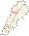
Berbara (Arabic: البربارة, also spelled al-Barbara) is a municipality in the Byblos District of Mount Lebanon Governorate, Lebanon. It is located along the Mediterranean coast, 48 kilometers north of Beirut. Berbara has an average elevation of 200 meters above sea level and a total land area of 314 hectares.[1] Its inhabitants are predominantly Maronite and Greek Orthodox Christians.[2]
References
- ^ "Berbara". Localiban. Localiban. 2008-01-16. Retrieved 2016-02-12.
- ^ "Elections municipales et ikhtiariah au Mont-Liban" (PDF). Localiban. Localiban. 2010. p. 19. Archived from the original (pdf) on 2015-07-24. Retrieved 2016-02-12.


