Jump to content

Erm, Netherlands

Coordinates: 52°45′16″N 6°49′1″E / 52.75444°N 6.81694°E / 52.75444; 6.81694
From Wikipedia, the free encyclopedia

This is an old revision of this page, as edited by Wagino 20100516 (talk | contribs) at 08:54, 13 May 2020 (→‎See also: clean up). The present address (URL) is a permanent link to this revision, which may differ significantly from the current revision.

Erm
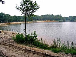
The Ermezand around Erm
Erm is located in Drenthe
Erm
Erm
Erm is located in Netherlands
Erm
Erm
Coordinates: 52°45′16″N 6°49′1″E / 52.75444°N 6.81694°E / 52.75444; 6.81694
CountryNetherlands
ProvinceDrenthe
MunicipalityCoevorden
Population
 (1 April 2004)
420

Erm is a village in the Netherlands and it is part of the Coevorden municipality in Drenthe. Its altitude is 14 metres (49 feet) +NAP and its population is about 420.

See also