
Bakonyszentkirály
Bakonyszentkirály | |
|---|---|
 | |
 Flag  Coat of arms | |
 Bakonyszentkirály Location of Bakonyszentkirály | |
| Coordinates: 47°21′56″N 17°52′48″E / 47.36562°N 17.88008°E | |
| Country | |
| County | Veszprém |
| Area | |
• Total | 27.90 km2 (10.77 sq mi) |
| Population (2011) | |
• Total | 826 |
| • Density | 29.61/km2 (76.7/sq mi) |
| Time zone | UTC+1 (CET) |
| • Summer (DST) | UTC+2 (CEST) |
| Postal code | 8430 |
| Area code | 88 |
Bakonyszentkirály is a village in Veszprém county, Hungary in Zirc District. It is a small village with a population of 826.[1] The village is situated in the Bakony mountains, some 40 km south of Győr and 50 km north of Lake Balaton.
The quiet, forested area surrounding Bakonyszentkirály, with its fresh air, is ideal for tourism.
Neighboring villages[2]
Gallery
-
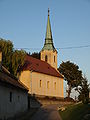
 Church by sunset
 -
 Church in Bakonyszentkirály 2009


Notes
References
External links


This Veszprém county location article is a stub. You can help Wikipedia by expanding it. |