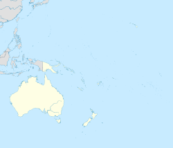
Cicia
Appearance
Cicia | |
|---|---|
Island | |
| Coordinates: 17°45′S 179°18′W / 17.750°S 179.300°W | |
| Country | Fiji |
| Island group | Northern Lau Islands |
| Area | |
| • Total | 34 km2 (13 sq mi) |

Cicia (pronounced [ðiˈði.a]) is a Fijian island of the Lau Group. One of the Northern Lau Islands, Cicia is volcanic and is composed of raised coral. Its area is 34 square kilometres (13 sq mi).
Cicia is inhabited and has an airport, Cicia Airport. The Australian magpie (Gymnorhina tibicen) was introduced to Cicia in order to control coconut pests and is now endemic to the island.
There are five villages on the island namely: Tarukua, Mabula, Lomati, Natokalau and Naceva.[1]
Regional support for organic farming
The island of Cicia has committed to having 100% of its farm agriculture produced organically. Another Pacific island to have made this commitment is Abaiang in Kiribati.[2]
References
- ^ House of Chiefs (Fiji)
- ^ Paull, John (2017) "Four New Strategies to Grow the Organic Agriculture Sector", Agrofor International Journal, 2(3):61-70.
Further reading
- Paull, J. (2006). "The farm as organism: The foundational idea of organic agriculture". Journal of Bio-Dynamics Tasmania. 83: 14–18.
{{cite journal}}: Invalid|ref=harv(help)
This article needs additional citations for verification. (August 2016) |


