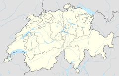
Goppenstein railway station
Goppenstein | |||||
|---|---|---|---|---|---|
 | |||||
| General information | |||||
| Location | Goppenstein, Ferden, Canton of Valais, Switzerland | ||||
| Coordinates | 46°22′03″N 7°45′20″E / 46.367431°N 7.7555°E | ||||
| Elevation | 1,217 m (3,993 ft) | ||||
| Owned by | BLS AG | ||||
| Operated by | BLS AG | ||||
| Line(s) | Lötschberg line | ||||
| Connections | PostAuto bus service | ||||
| Services | |||||
|
Lua error in Module:Adjacent_stations at line 237: Unknown line "RegioExpress". | |||||
| |||||
Goppenstein is a railway station in the Swiss canton of Valais and municipality of Ferden. The station is located on the Lötschberg line of the BLS AG, just outside the southern portal of the Lötschberg tunnel. It takes its name from the nearby hamlet of Goppenstein.[1]
The station is served by the following passenger train:[2]
| Operator | Train Type | Route | Typical Frequency |
Notes |
|---|---|---|---|---|
| BLS | RegioExpress Lötschberger |
Bern - Münsingen - Thun - Spiez - Mülenen - Reichenbach im Kandertal - Frutigen - Kandersteg - Goppenstein - Hohtenn - Ausserberg - Eggerberg - Lalden - Brig | 1 per hour |
The station is also the southern terminus of the BLS car carrying shuttle train to Kandersteg station via the Lötschberg tunnel, with trains running every 30 minutes. There is no road across the Lötschen Pass, under which the tunnel runs, and the nearest alternative road crossings lie many kilometres to the east and west.[3]
A connecting PostAuto bus service runs through the Lötschental valley between Steg and Fafleralp. Up the valley towards Fafleralp this route runs hourly and serves the valley communities of Ferden, Kippel, Wiler and Blatten. Alternate buses continue down the valley to Steg.[4]
References
- ^ map.geo.admin.ch (Map). Swiss Confederation. Retrieved 2013-10-14.
- ^ "Spiez–Lötschberg–Brig" (PDF). Bundesamt für Verkehr. Retrieved 2013-10-14.
- ^ "Lötschberg Kandersteg–Goppenstein" (PDF). Bundesamt für Verkehr. Retrieved 2013-10-14.
- ^ "Gampel-Steg–Hohtenn–Goppenstein–Blatten (Lötschen)–Fafleralp" (PDF). Bundesamt für Verkehr. Retrieved 2013-10-14.
External links
 Media related to Goppenstein railway station at Wikimedia Commons
- Goppenstein railway station – SBB

