Dunaföldvár
Appearance
Dunaföldvár | |
|---|---|
 View of the town from its bridge | |
| Coordinates: 46°48′32″N 18°55′05″E / 46.80889°N 18.91797°E | |
| Country | |
| County | Tolna |
| Area | |
| • Total | 111.42 km2 (43.02 sq mi) |
| Population (2004) | |
| • Total | 9,320 |
| • Density | 83.64/km2 (216.6/sq mi) |
| Time zone | UTC+1 (CET) |
| • Summer (DST) | UTC+2 (CEST) |
| Postal code | 7020 |
| Area code | 75 |
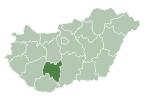
Dunaföldvár is a town in Tolna County, Hungary. Residents are Hungarians, with minority of Serbs. A Bronze Age gold hoard of jewellery was found between Paks and Dunaföldvár on the banks of the Danube in the nineteenth century. The treasure is now in the collections of the British Museum.[1]
Twin towns — sister cities
Dunaföldvár is twinned with:
 Weikersheim, Germany
 Ossona, Italy


Personalities
- Piroska Oszoli (1919-2017) painter, The Lover of Danube
See also
External links
- Street map (in Hungarian)


