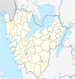
Alafors
Alafors | |
|---|---|
Town | |
 | |
| Coordinates: 57°55′30″N 12°5′13″E / 57.92500°N 12.08694°E | |
| Country | |
| Province | Västergötland |
| County | Västra Götaland County |
| Municipality | Ale Municipality |
| Population (2010) | |
| • Total | 1,520 |
| Time zone | UTC+1 (CET) |
| • Summer (DST) | UTC+2 (CEST) |
Alafors is a town and the seat of the municipality of Ale Municipality, Västra Götaland County, Sweden. Today it is considered part of Nödinge-Nol, a northeastern neighborhood. It is located off the E45, about 30 km north of Gothenburg and approximately 1 km from the east bank of the Göta River.
In 1970 the town grew up with the railroad town Nol and 1990 with Nödinge, which today form an urban area, Nödinge-Nol. Alafors contains the Ale municipal building, whose facade has enamel artwork by Endre Nemes. There is a high school, park, Ahlafors IF football club which play at Furulundsparken,[1] and a ski slope. A former spinning mill was located here which ceased operations in 1966. Swedish death metal group Eructation was formed in Alafors in 1988.[2]
Notable people
- Erik Arvidsson - chess player[3]
References
- ^ "Fotbollsskola Sjövallen" (in Swedish). Laget.se. Retrieved 6 May 2012.
- ^ Ekeroth, Daniel (29 July 2008). Swedish Death Metal. Bazillion Points Books. p. 342. ISBN 978-0-9796163-1-0. Retrieved 6 May 2012.
- ^ Knudsen, John C. (1 February 2003). Chess Without Borders: The Life and Games of Iccf Im Sture Nyman. iUniverse. p. 4. ISBN 978-0-595-27021-7. Retrieved 6 May 2012.


