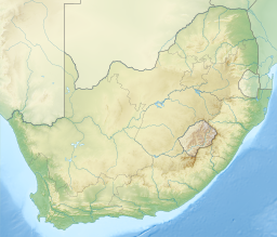
Lake Chrissie
Appearance
| Lake Chrissie | |
|---|---|
| Chrissiesmeer Error {{native name checker}}: parameter value is malformed (help) | |
| Location | Msukaligwa Local Municipality, Mpumalanga, South Africa |
| Coordinates | 26°20′S 30°13′E / 26.333°S 30.217°E |
| Type | lake |
| Max. length | 9 kilometres (5.6 mi) |
| Max. width | 3 kilometres (1.9 mi) |
| Max. depth | 6 metres (20 ft) |
Lake Chrissie (Template:Lang-af) is a lake in Msukaligwa Local Municipality, Mpumalanga, South Africa. It is a shallow and large lake, with a maximum depth of about 6 metres (20 ft), 9 kilometres (5.6 mi) long, 3 kilometres (1.9 mi) wide. The lake is named after Christiana Pretorius, daughter of Marthinus Wessel Pretorius, first president of the boer Transvaal Republic.[1] The lake is also informally known as "Matotoland" (meaning "land of frogs") and its swazi name is "Kachibibi" (meaning "big lake").[2]
A famous battle of the Second Boer War was fought by Lake Chrissie on 6 February 1901.
See also
- Chrissiesmeer, a local settlement
Footnotes
- ^ Chrissiesmeer
- ^ Wellington, J.H. (April 1943). "The Lake Chrissie Problem". South African Geographical Journal. 25 (1): 50–64. doi:10.1080/03736245.1943.10559227. ISSN 0373-6245.
References
- Encyclopædia Britannica entry on Lake Chrissie
- Chrissiesmeer at Routes Travel Info

