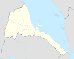
Debarwa
Debarwa
ድባርዋ دباروا | |
|---|---|
town | |
| Coordinates: 15°06′N 38°50′E / 15.100°N 38.833°E | |
| Country | |
| Region | Debub |
| District | Debarwa |
| Population | |
• Total | 25,000 |
| Time zone | UTC+3 (EAT) |
Debarwa (Template:Lang-ti Tigrinya pronunciation: [dɨbarwa]) is a market town in central Eritrea. It is situated about 25 kilometers south of the capital Asmara, and has a population of about 25,000 inhabitants.[1] It is the capital of the Debarwa district (Tsilima) in the Debub ("Southern") administrative region (one of five in Eritrea).
History
Debarwa was formerly the capital of an ancient Kingdom named Medri Bahri, which roughly translates as Land of the Sea. It was ruled by the Bahr Negus (King of the Sea). The Portuguese expedition under Cristóvão da Gama spent the rainy season of 1542 in Debarwa as the guests of the Bahr Negus.[2] The Ottomans invaded part of Medri Bahri in 1557, and for several decades struggled for control over the local population and their Ethiopian neighbors. By the time everything settled, the Ottomans were confined to Suakin, Massawa, Hergigo and the immediate hinterlands, but at times their raids would reach into the Bogos, Hamasien and Habab districts of Eritrea.[3]
In 1559 the Ottoman Empire's advance into Medri Bahri was halted in Debarwa by an influenza epidemic that felled thousands of Ottoman troops, forcing the army to retreat to the ports and halting the Ottoman army's advance of their administrative territory into the Eritrean highlands.[4][5]
The city was also hard hit by a typhus epidemic in 1893, which followed the misery of the Great Famine (1888-1892). A French visitor described Debarwa as "decimated", and all that was left of the once prosperous town were "a few piles of stones, an almost ruined church, and a few wretched hovels".[6]
Demographics
The majority of the population in Debarwa belongs to the Bihér-Tigrigna (Tigrinya-speaking) ethnic group. In terms of faith, local residents are mainly adherents of the Eritrean Orthodox Tewahdo Church.
Economy
Local people bring produce such as potatoes, tomatoes, chickens and grain to the market every Saturday. Aside from being a market town, it is also a mining town with resources of high grade gold, copper, silver and zinc, and an important transport route between the south-west corner of Zoba Debub and Asmara. The Japanese company Hitachi once operated a mine near Debarwa, but it was shut down in the 1960s due to the outbreak of the Eritrean War of Independence from Ethiopia.[citation needed]
References
- ^ Older writers, such as Samuel Purchas, often use a corrupt form of its name, "Barua".
- ^ R.S. Whiteway, editor and translator, The Portuguese Expedition to Abyssinia in 1441-1543, 1902. (Nendeln, Liechtenstein: Kraus Reprint, 1967), pp. xlvif, 9
- ^ Richard Pankhurst, The Ethiopian Borderlands (Trenton: Red Sea Press, 1997), pp. 234-238
- ^ Welch, Sidney R. (1949). South Africa Under John III, 1521-1557. Juta. p. 244.
- ^ Whiteway, R. S. (2017-05-15). The Portuguese Expedition to Abyssinia in 1541-1543, as narrated by Castanhoso: With Some Contemporary Letters, the Short Account of Bermudez, and Certain Extracts from Correa. Taylor & Francis. ISBN 978-1-317-01974-9.
- ^ Richard Pankhurst, An Introduction to the Medical History of Ethiopia (Trenton: Red Sea Press, 1990), p. 36

