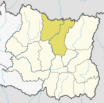
Wana, Nepal
Appearance
Panchkhappan Municipality
पाँचखप्पन नगरपालिका | |
|---|---|
| Coordinates: 27°33′N 87°00′E / 27.55°N 87.00°E | |
| Country | |
| Zone | Kosi Zone |
| District | Sankhuwasabha District |
| Population (1991) | |
| • Total | 14,881 |
| Time zone | UTC+5:45 (Nepal Time) |
Panchkhappan (पाँचखप्पन) is a Municipality in Sankhuwasabha District in the Kosi Zone of north-eastern Nepal. The municipality was established on 19 September 2017 by merging the existing Wana, Jaljala, and Syabun village development committees (VDCs). The municipality office is established at Wana Bazzar, near to Wana Higher Secondary School. After merging three VDCs' population, it has a population of 14,881 people living in 2,870 individual households according to 1991 Nepal census .[1]
References
- ^ "Nepal Census 2001". Nepal's Village Development Committees. Digital Himalaya. Archived from the original on 12 October 2008. Retrieved 19 November 2008.
External links


