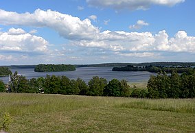
Žemaitija National Park
Appearance
| Žemaitija National Park | |
|---|---|
 Plateliai lake | |
 | |
| Location | Lithuania |
| Coordinates | 56°02′38″N 21°53′20″E / 56.044°N 21.889°E |
| Area | 217.54 km2 (83.99 sq mi) |
| Established | 1991 |
Samogitia National Park or Žemaitija National Park is a national park in Lithuania. It is situated on the Samogitian Highlands, 45 km from the Baltic Sea. Lakes cover more than 7% of its territory. Lake Plateliai (12.05 km², 47 m depth) is the largest lake. The town of Plateliai, situated on the shore of the lake, is the seat of the park's administration and a popular tourist destination. The Park has Category II in the classification of the IUCN.[1]
See also

References
- ^ Zemaitijos Nacionalinis Parkas in Lithuania Protected Planet
