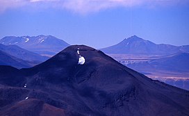
Cerro Colorados
Appearance
| Colorados | |
|---|---|
 Colorados is the long chain mountain on the left in the distance. Seen from near Ojos del Salado | |
| Highest point | |
| Elevation | 6,080 m (19,950 ft) |
| Prominence | 1,043 metres (3,422 ft) |
| Listing | Category:Six-thousanders_of_the_Andes |
| Coordinates | 26°11′S 068°23′W / 26.183°S 68.383°W |
| Geography | |
| Parent range | Puna de Atacama, Andes |
Cerro Colorados is a mountain in the Andes. It has a height of 6,080 metres (19,950 ft). It and the neighbouring peak of Vallecitos lie in a very remote area west of the Salar de Antofalla and were not climbed until 1999.[1]
See also
References
- ^ Biggar, John (2020). The Andes - A Guide for Climbers and Skiers (5th ed.). p. 330. ISBN 978-0-9536087-6-8.
31°46′S 70°44′W / 31.767°S 70.733°W
