
Koishikawa-Kōrakuen
| Koishikawa Kōrakuen Garden | |
|---|---|
| Koishikawa Kōrakuen (小石川後楽園) | |
 Pond of Koishikawa-Kōrakuen | |
 | |
| Type | Urban park |
| Location | Koishikawa, Bunkyō, Tokyo, Japan |
| Coordinates | 35°42′20″N 139°44′57″E / 35.705556°N 139.749167°E |
| Created | 1629 |


Koishikawa-Kōrakuen is a seventeenth-century garden in Koishikawa, Bunkyō, Tokyo. The garden was begun by Mito Yorifusa in 1629, and completed by his son Mito Mitsukuni.[1] It was created with advice from the Chinese scholar Zhu Zhiyu, and incorporates elements of both Chinese and Japanese taste.[2]
It is one of three surviving daimyō gardens of the many that were created in Edo after it became the military capital of the country, the others being the Rikugi-en and the Hama Rikyū gardens.[3]
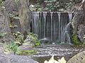
Gallery
-
 Autumn colours of leaves at Koishikawa-Kōrakuen
 -
 Autumn colours of Daisensui (big pond)
 -

-

-

-


.JPG)


See also
References
- ^ Parks in Tokyo Metropolitan. Tokyo Metropolitan Park Association. Accessed September 2017.
- ^ Martin Zatko (2017). The Rough Guide to Tokyo. London: Rough Guides. ISBN 9780241279120
- ^ David Young, Michiko Young (2012). The Art of the Japanese Garden. Kanagawa: Tuttle Publishing. ISBN 9781462905829