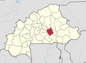
Ganzourgou Province
Ganzourgou | |
|---|---|
Province | |
 Location in Burkina Faso | |
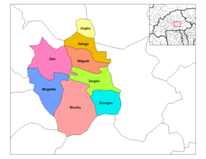
 Provincial map of its departments | |
| Country | |
| Region | Plateau-Central Region |
| Capital | Zorgho |
| Area | |
| • Total | 1,613 sq mi (4,178 km2) |
| Population (2006) | |
| • Total | 319,830 |
| Time zone | UTC+0 (GMT 0) |
Ganzourgou is a province of Burkina Faso and is in Plateau-Central Region. The capital of Ganzourgou is Zorgho, which is along the road between Ouagadougou and Niamey, Niger. Other important localities in the province are Mogtédo and Méguet. The population of Ganzourgou in 2006 was 319,830.[1]
Ganzourgou is divided into 8 departments:
| Commune | Capital | Population (Census 2006)[1] |
|---|---|---|
| Boudry Department | Boudry | 80,948 |
| Kogho Department | Kogho | 15,790 |
| Méguet Department | Méguet | 34,724 |
| Mogtédo Department | Mogtédo | 50,809 |
| Salogo Department | Salogo | 21,405 |
| Zam Department | Zam | 39,582 |
| Zorgho Department | Zorgho | 46,898 |
| Zoungou Department | Zoungou | 29,674 |
See also
References
- ^ a b National 2006 census preliminary results [1] Archived 2015-07-21 at the Wayback Machine
12°14′17″N 0°47′08″W / 12.23806°N 0.78556°W
