
Geiyo Islands
Native name: 芸予諸島 Geiyo Islands | |
|---|---|
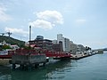
 View of Geiyo Islands and Shimanami Kaidō from Imabari, Ehime | |
 Geiyo Islands Location in Japan  Geiyo Islands Geiyo Islands (Hiroshima Prefecture) | |
| Geography | |
| Location | Seto Inland Sea |
| Coordinates | 34°17′02″N 133°05′03″E / 34.283967°N 133.084169°E |
| Archipelago | yes |
| Major islands | 43 |
| Length | 98 km (60.9 mi) |
| Width | 38 km (23.6 mi) |
| Administration | |
Japan | |
| Prefecture | Hiroshima and Ehime |
| Demographics | |
| Ethnic groups | Japanese |
The Geiyo Islands (芸予諸島, Geiyo Shotō) are a group of islands in the Seto Inland Sea of Hiroshima Prefecture. They are roughly defined as laying in the western part of Seto Inland Sea, from Hiuchi-nada to Aki-nada. Largest islands in archipelago are connected by Nishiseto Expressway bridge system connecting Honshu and Shikoku islands. Alternative and narrower definition is the "all islands laying between ancient Iyo Province and Bizen Province". The islands of in Hiroshima Bay, most notably Etajima and Kurahashi-jima, are therefore excluded from the Geiyo Islands archipelago narrower definition.
Economy and industry
The Geiyo Islands, due to the calm yet deep waters of the Seto Inland Sea, are one of the main hubs of shipbuilding,[1] fishing, and aquaculture in Japan.
List of the islands
The major (over 1 km2 area) islands in the group are:
- Ikuchi-jima
- Mukaishima Island, Hiroshima
- Ōsakikamijima, Hiroshima
- Ōsakishimo-jima
- Innoshima, Hiroshima
- Ōmishima Island, Ehime
- Ōshima (Ehime)
- Etajima1
- Kurahashi-jima1
- Itsukushima1
- Hakata, Ehime
- Kamikamagari-jima
- Shimokamagari-jima
- Iwagi-jima
- Sagishima
- Yugeshima
- Tashima, Hiroshima
- Ōkurokamishima
- Toyoshima, Hiroshima
- Takaneshima
- Yokoshima, Hiroshima
- Ninoshima1
- Ikina-jima
- Okamura Island
- Momoshima, Hiroshima
- Sashima, Ehime
- Kashima Island, Ehime
- Iwashi-jima
- Atata-jima1
- Ikunoshima
- Nii Ōshima
- Hashiri-jima
- Akahone-jima
- Ōgeshima
- Oshiba island
- Tsushima, Ehime
- Uoshima, Ehime
- Takaikamishima
- Hōjōkashima
- Nagashima, Hiroshima
- Kanawa-jima
- are not included in narrower definition of archipelago
Other minor islands:
- Umashima, Ehime
- Chigiri-shima, Hiroshima
- Mikado-jima, Hiroshima
- Hoso-jima
- Kōge-jima, Ehime
- Kuru-shima, Ehime
- U-shima, Ehime
- Ikuno-shima, Hiroshima
- O-shima, Ehime
- Itsuki-jima, Hiroshima
- Uma-shima, Ehime
- Kosagi-jima, Hiroshima
- Ōkunoshima, Hiroshima
- Nasake-shima
- Okino-shima, Hiroshima
- Hiki-shima, Ehime
- Toyo-shima, Ehime
- Michika-jima, Ehime
- Hyōtan-jima, Ehime and Hiroshima
- Hyakkan-jima, Ehime
Gallery
-
 The urban area of Innoshima
 -
![JMSDF Officer Candidate School [ja] in Etajima (the former Imperial Japanese Naval Academy)](//upload.wikimedia.org/wikipedia/commons/thumb/9/99/Japanesenavalacademy001.JPG/120px-Japanesenavalacademy001.JPG)
-
![Chigiri-shima [ja]](//upload.wikimedia.org/wikipedia/commons/thumb/f/f5/Chigirishima001.jpg/120px-Chigirishima001.jpg)
-
![The fishing port in Iwagi-jima [ja]](//upload.wikimedia.org/wikipedia/commons/thumb/2/21/Iwagijima.JPG/120px-Iwagijima.JPG) The fishing port in Iwagi-jima
The fishing port in Iwagi-jima

![JMSDF Officer Candidate School [ja] in Etajima (the former Imperial Japanese Naval Academy)](/wiki/File:Japanesenavalacademy001.JPG)
![Chigiri-shima [ja]](/wiki/File:Chigirishima001.jpg)
![The fishing port in Iwagi-jima [ja]](/wiki/File:Iwagijima.JPG)