Gontougo
Appearance
Gontougo Region
Région du Gontougo | |
|---|---|
| Motto(s): "Union, fraternité, développement" | |
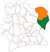
 Location of Gontougo Region (green) in Ivory Coast and in Zanzan District | |
| Country | |
| District | Zanzan |
| Established | 2011 |
| Regional seat | Bondoukou |
| Government | |
| • Prefect | François Germain Goun |
| • Council President | Kouassi Ignace Kossonou |
| Area | |
| • Total | 16,770 km2 (6,470 sq mi) |
| Population (2014)[3] | |
| • Total | 667,185 |
| • Density | 40/km2 (100/sq mi) |
| Time zone | UTC+0 (GMT) |
Gontougo Region is one of the 31 regions of Ivory Coast. Since its establishment in 2011, it has been one of two regions in Zanzan District. The seat of the region is Bondoukou and the region's population in the 2014 census was 667,185.
Gontougo is currently divided into five departments: Bondoukou, Koun-Fao, Sandégué, Tanda, and Transua.
Notes
- ^ "Préfets de Région et de Préfets de Département (Conseil des ministres du mercredi 26 septembre 2012)", abidjan.net, 2 October 2012.
- ^ "Gontougo", gouv.ci, accessed 23 February 2016.
- ^ "Côte d'Ivoire". geohive.com. Retrieved 5 December 2015.
8°2′N 2°47′W / 8.033°N 2.783°W


