Baekunsan
| Baekunsan | |
|---|---|
| Korean name | |
| Hangul | |
| Hanja | |
| Revised Romanization | Baek-unsan |
| McCune–Reischauer | Paekunsan |
| Highest point | |
| Elevation | 885 m (2,904 ft) |
| Coordinates | 35°35′42″N 128°59′02″E / 35.595°N 128.984°E |
| Geography | |
| Location | Ulsan, South Korea |
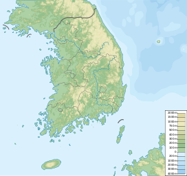
Baekunsan (lit. White Cloud Mountain) is a mountain located in Duseomyeon, Ulju County, Ulsan, South Korea. It was previously named Albaksan (Korean: 알박산) during the Silla Dynsasy. It has an elevation of 885 m (2,904 ft).[1]
See also
- Geography of Korea
- List of South Korean tourist attractions
- List of mountains in Korea
- Mountain portal
- South Korea portal
References
- ^ "Baekun-san 백운산 (885m)". Koreantrails.com. Archived from the original on 12 September 2018. Retrieved 3 July 2013.

