Clondulane
Clondulane
Cluain Dalláin | |
|---|---|
Village | |
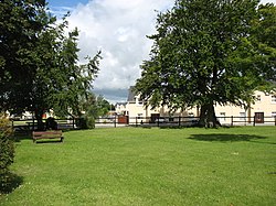
 Clondulane village green | |
| Coordinates: 52°08′33″N 08°13′24″W / 52.14250°N 8.22333°W | |
| Country | Ireland |
| Province | Munster |
| County | County Cork |
| Population (2016)[1] | |
| • Total | 417 |
| Time zone | UTC+0 (WET) |
| • Summer (DST) | UTC-1 (IST (WEST)) |
Clondulane (Irish: Cluain Dalláin)[2] is a village in north County Cork, Ireland, 3.5m east of Fermoy, just off the Main Fermoy-Dungarvan Road. Originally built as a camp for the workers of a Cork Milling Company grain mill,[3] it now has a population of over 400.[1] Clondulane is part of the Cork East Dáil constituency.
There are three large houses of note in the village: Clondulane, Glandulane, and Careysville Houses, the latter being owned by the Duke of Devonshire (England) and used as a lodging house during the salmon season. Along with several housing estates and many stand alone dwellings, there is a school, community centre, public house, playing fields, park, disused railway station, factory, a Protestant school, Protestant church and graveyard.
Transport
Rail
Clondulane railway station opened on 27 September 1872, but closed on 27 March 1967.[4] It was located on the now dismantled Waterford to Mallow line and served by the Rosslare to Cork boat train.[5]
See also
References
- ^ a b "Census 2016 – Small Area Population Statistics (SAPMAP Area) – Settlements – Clondulane". Census 2016. Central Statistics Office.
- ^ Placenames Database of Ireland. Cluain Dalláin Verified 2011-03-05.
- ^ Nielstrom, N (1992) "Cork Milling Company", Falon Publishing, Dublin, Ireland
- ^ "Clondulane station" (PDF). Railscot – Irish Railways. Retrieved 2007-09-17.
- ^ http://eiretrains.com/Photo_Gallery/Railway%20Stations%20C/Clondulane/IrishRailwayStations.html
52°08′33″N 8°13′24″W / 52.14250°N 8.22333°W

