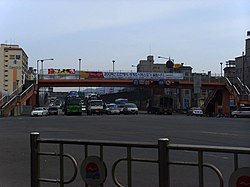
Michuhol District
Appearance
Michuhol
미추홀구 | |
|---|---|
| Korean transcription(s) | |
| • Hanja | 彌鄒忽區 |
| • Revised Romanization | Michuhol-gu |
| • McCune-Reischauer | Mich'uhol-gu |
 | |
 | |
| Country | South Korea |
| Region | Sudogwon |
| Provincial level | Incheon |
| Administrative divisions | 21 administrative dong |
| Area | |
| • Total | 24.84 km2 (9.59 sq mi) |
| Population (2020) | |
| • Total | 407,369 |
| • Density | 16,000/km2 (42,000/sq mi) |
| • Dialect | Seoul |
| Website | Michuhol District Office |
Michuhol District (Michuhol-gu) is a municipal district in Incheon, South Korea. This district was called Nam (South) District until July 1, 2018.[1]
Michuhol-gu was the centre of pre-modern Incheon: historical sites such as Munhaksan(Mt.), Dohobucheongsa (the old office building of old Incheon), Incheon Hyanggyo (local public school of old Incheon) are located in Michuhol-gu.
Michuhol-gu is a highly populated area and one of the old city centres in hearts of native residents.
Michuhol-gu has been the centre of higher education in Incheon; University of Incheon and Inha University are located in Michuhol-gu.
Administrative Divisions of Incheon Michuhol-gu

- Dohwa 1 to 3 Dong
- Sungui 1 to 4 Dong
- Yonghyeon 1 to 5 Dong
- Juan 1 to 8 Dong
- Hagik 1 and 2 Dong
- Gwangyo-dong
- Munhak-dong
References
- ^ 인천 '남구'→'미추홀구' 변경…7월 1일부터 시행 연합뉴스, 2018.2.28.
External links
- Michuhol-gu homepage (in English)
Wikimedia Commons has media related to Michuhol-gu, Incheon.
