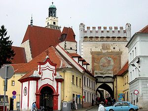
Prachatice District
Prachatice District
Okres Prachatice | |
|---|---|
 | |
 District location in the South Bohemian Region within the Czech Republic | |
| Country | Czech Republic |
| Region | South Bohemian |
| Capital | Prachatice |
| Area | |
• Total | 1,375.03 km2 (530.90 sq mi) |
| Population (2019-01-01[1]) | |
• Total | 50,971 |
| • Density | 37/km2 (96/sq mi) |
| Time zone | UTC+1 (CET) |
| • Summer (DST) | UTC+2 (CEST) |
| Municipalities | 65 |
| * Towns | 6 |
| * Market towns | 4 |
| * Villages | 55 |
Prachatice District (Template:Lang-cs) is a district (okres) within South Bohemian Region of the Czech Republic. Its capital is Prachatice.
Complete list of municipalities
Babice - Bohumilice - Bohunice - Borová Lada - Bošice - Budkov - Buk - Bušanovice - Chlumany - Chroboly - Chvalovice - Čkyně - Drslavice - Dub - Dvory - Horní Vltavice - Hracholusky - Husinec - Kratušín - Křišťanov - Ktiš - Kubova Huť - Kvilda - Lažiště - Lčovice - Lenora - Lhenice - Lipovice - Lužice - Mahouš - Malovice - Mičovice - Nebahovy - Němčice - Netolice - Nicov - Nová Pec - Nové Hutě - Olšovice - Pěčnov - Prachatice - Radhostice - Stachy - Stožec - Strážný - Strunkovice nad Blanicí - Šumavské Hoštice - Svatá Maří - Těšovice - Tvrzice - Újezdec - Vacov - Vimperk - Vitějovice - Vlachovo Březí - Volary - Vrbice - Záblatí - Zábrdí - Zálezly - Zbytiny - Zdíkov - Žárovná - Želnava - Žernovice
References
- ^ "Population of municipalities of the Czech republic". Czech Statistical Office. Retrieved 2019-04-30.
49°00′46″N 13°59′50″E / 49.01278°N 13.99722°E
