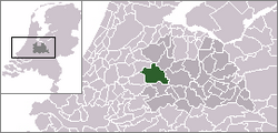
Gerverscop
Appearance
Gerverscop | |
|---|---|
Hamlet | |
 | |
 The statistical district of Gerverscop in the municipality of Woerden. | |
| Coordinates: 52°06′58″N 4°56′58″E / 52.11611°N 4.94944°E | |
| Country | Netherlands |
| Province | Utrecht |
| Municipality | Woerden |
| Population (2007) | |
• Total | 150 |
| Time zone | UTC+1 (CET) |
| • Summer (DST) | UTC+2 (CEST) |
Gerverscop is a hamlet in the Dutch province of Utrecht. It is a part of the municipality of Woerden, and lies about 5 km northeast of Woerden. Until 1857, it was a separate municipality; it then was joined to the municipality of Harmelen.[1]
The former municipality consisted of the polders Gerverscop and Breudijk, north of Harmelen. In the 19th century, it had about 160 inhabitants, 120 of which in the polder Gerverscop.[2] The current statistical district "Gerverscop", which covers the hamlet and the surrounding polder, has a population of around 150.[3]
References
- ^ Ad van der Meer and Onno Boonstra, Repertorium van Nederlandse gemeenten, KNAW, 2011.
- ^ Abraham Jacob van der Aa, "Aardrijkskundig woordenboek der Nederlanden", vol. 4 (E-G), 1843.
- ^ Statistics Netherlands (CBS), Statline: Kerncijfers wijken en buurten 2003-2005 "Archived copy". Archived from the original on 2006-07-24. Retrieved 2006-07-24.
{{cite web}}: CS1 maint: archived copy as title (link). As of 1 January 2005.
